Hutton Roof and NewbigginBetween the Lakes and the Dales |
History |
| Home |
| Fell Race |
| Country Fair |
| Village Hall |
| Past Events |
| Future Events |
| St John's Church |
| Local Producers |
| Accommodation |
| Nature |
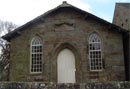
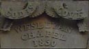
| History |
This site is provided and maintained by Hutton Roof Village Hall |
|
|||||||||||||||||||||||||